[Note: This section has been examined in minute detail in our book: Glen L. Thompson and Mark Wilson, In This Way We Came to Rome: With Paul on the Appian Way (Lexham Press, 2024), pp. 90–107]
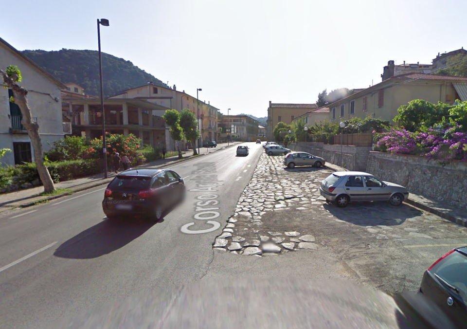
The Via Appia in the direction of Rome continued out the western end of Itri underneath the modern Corso Appio Claudio. Evidence is provided by the bit of Roman paving seen where that street merges onto the SS7 at the edge of the city. From there the ancient road continued along the path of the modern SS7 for another 2.6 km until the modern highway begins a bend westwards. At that point the ancient road continued straight beneath the current dirt road for 350 m with paving visible to confirm the path.
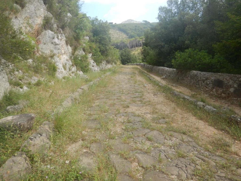
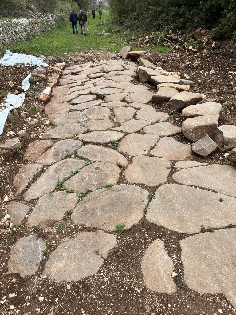
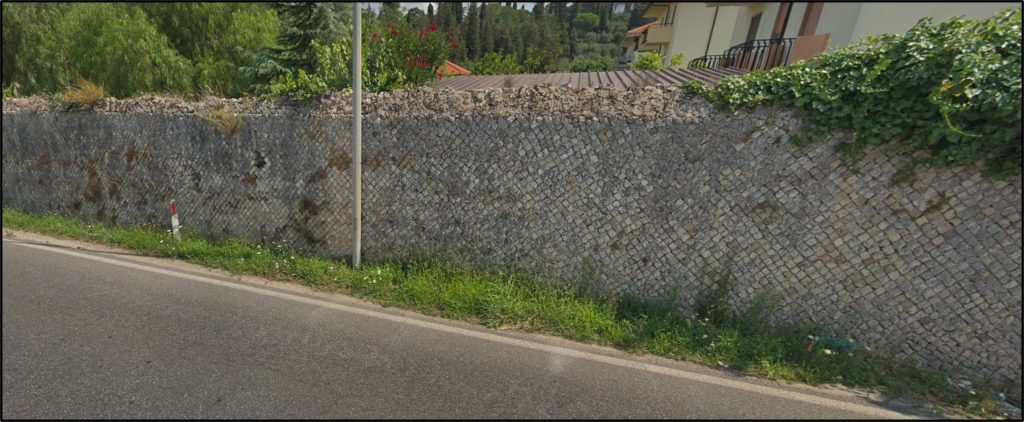
After the road passes beneath the current SS7 is the longest stretch of preserved VA paving that has survived (except for the stretch at the edge of Rome itself). One mile of the road has been preserved and is now part of the larger Monte Aurunci Regional Nature Park. Halfway along this stretch, Paul’s party would have passed beneath a temple of Apollo, situated on a hill on the south side of the road. The road here followed a small stream, and at the end of this section it crossed via a bridge that also is extant. Once on the north side of the stream the road again headed north (beneath the current dirt road) and 300 m later rejoined the path of the SS7. The road then ran straight another 4.5 km to the edge of ancient Fundi (modern Fondi). The path is again confirmed by a long Roman retaining wall of opus reticulatum on the north side of the road shortly before Fundi, probably to keep travelers out of an ancient country villa and its orchards.
Fundi was an important city already when the Via Appia was constructed, controlling the small fertile plain around it. The five miles between it and the Mediterranean were quite marshy, however, explaining why the VA was routed this far inland. 850 m after the end of the wall, the road (today named the Via Appio Lato Itri) veered to the right (beneath the modern Corso Italia) and ran a final 250 m to the eastern gate of Fundi. It then became the main decumanus of this ancient Roman city, running 500 m through the center of town to arrive at the western gate. At a fairly early time a “bypass” was constructed which allowed the travelers to avoid the city center and just continue straight following the outside of the southern city wall. Having traveled about 10 RM from Itri, Paul’s party must have stopped for a break and refreshments at Fundi.
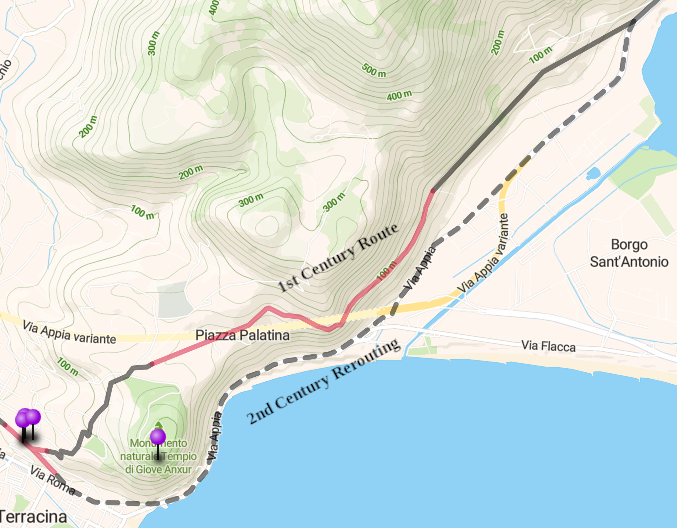
Just outside the western gate, the road veered southwest (today’s Via Roma) in a straight line for the next 7 km, running in the shadow of Mount Ausoni. A large Roman tomb just outside of Fundi and milestone 71 found several kilometers further along confirm the route. The road then curved southward around two outcroppings, following approximately the path of the modern SS7 for about 7 km. A Roman exedra, its ruins still visible next to the SS7, was built as a rest stop for the travelers at the point where the road began to climb up and inland toward the city of Tarracina (modern Terracina). A generation after Paul passed this way, Trajan’s engineers undertook to cut a passageway along the shore to avoid the steep climb. A section of the paving of that alternative route is preserved inside the grounds of the Villa Salvini in Tarracina.
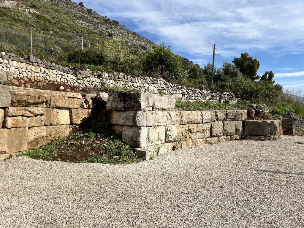
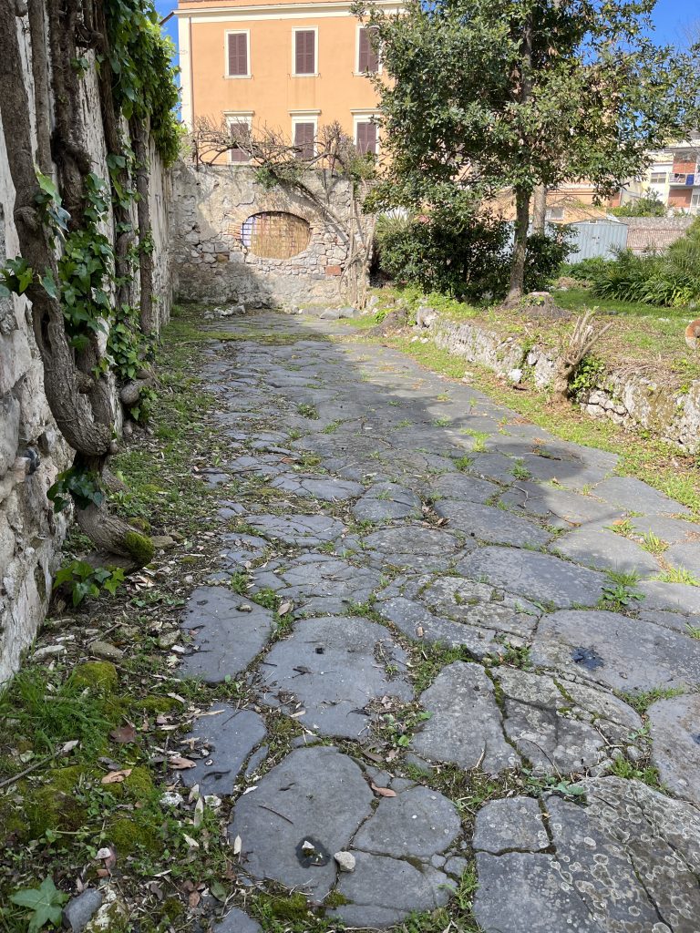
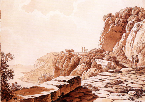
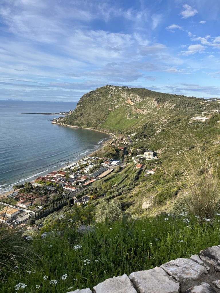
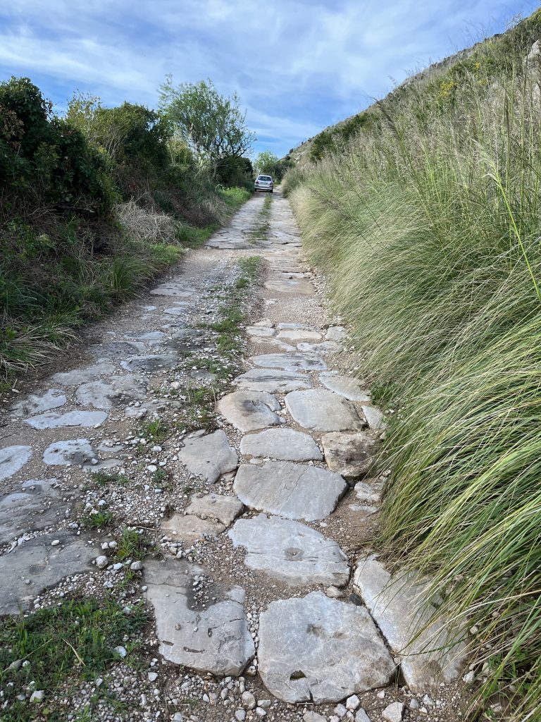
Paul and his party, however, had to climb the original path of the VA. It was still 5 km to the walls of Tarracina, and they would need to pass over a ridge 150 m in height. Although the first two kilometers are lost under the cultivated orchards, the present Via Piazza Palatina preserves much of the rest of the route. While the ancient pavement is not continuously visible, it still appears from time to time in the current road (see the map above). The modern street name comes from a rest stop halfway up the hill where the road widens (hence piazza) and gives a spectacular view of the gulf far below. Once on top of the ridge, the road descended again somewhat, following the modern Via Anxur into the forum of Tarracina. Far above to the south was perched the impressive Temple of Jupiter Anxur overlooking the bay.
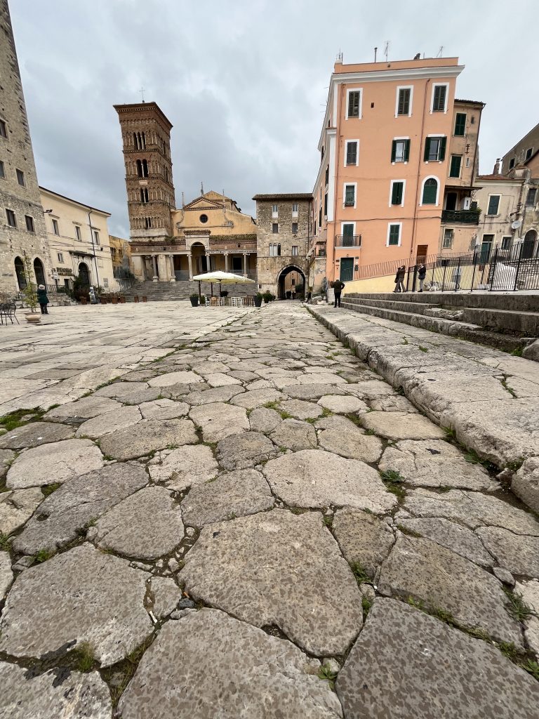
The VA ran straight across the eastern end of the ancient forum, and its paving has been preserved. The city had been reorganized as a Roman colony twenty years before the VA was constructed and was incorporated into it from the beginning. After the steep climb, and having traveled 20 RM (30 km) from Itri, Paul’s party most likely spent a night in Tarracina.
Created by GLT
Last updated 07/14/2026 JTS